How to use EJAM to analyze zip codes
EJAM can analyze various kinds of Census-defined areas, including States, Counties, Tracts, Blockgroups, and Cities/CDPs/etc.
However, you may need to analyze zip codes.
Census uses ZIP Code Tabulation Areas (ZCTAs), which are generalized
areal representations of United States Postal Service (USPS) ZIP Code
service areas. See help("zctas", package="tigris")
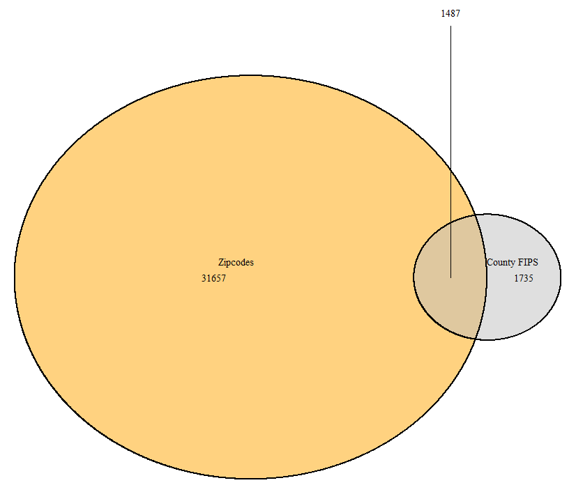
Note a zip can be the same as a county fips in many cases, as with 10001!
EJScreen’s API does not handle zip codes. It can show where the center of the zip code is but will not map its bounds or provide a report easily via the API.
# Just see where the zipcode is, not its boundaries
browseURL(url_ejscreenmap(wherestr =  '10001'))
To map and analyze zip codes you can download shapefiles for them and analyze or map them in EJAM as shown below.
downloading zcta polygons
Takes time to download!
library(tigris)
options(tigris_use_cache=TRUE)
options(tigris_refresh=FALSE)
#zcta_DE <- zctas(starts_with = fips_from_name('DE'), keep_zipped_shapefile = T) # all in the state
#zcta1 <- zctas(starts_with = c("10001"))  # one zip
zcta2 <- zctas(starts_with = c("10012", "10506"))  # two zipcodes

z = shapefile_from_any(zcta2)
mapping zcta polygons
mapfast(z)analyzing zip codes in EJAM
The EJScreen API does not handle zip codes, but you can analyze them in EJAM like this:
out = ejamit(shapefile = z, radius = 0)summary report on zipcodes
ejam2report(out,
            analysis_title = "Zip codes",
            submitted_upload_method = 'SHP',
            shp = z)
compare sites
# put zip code in the x axis labels!
ejam2barplot_sites(out, names.arg = z$GEOID20, sortby = FALSE) # zcta2$GEOID20

# This table view works, but the links to reports do not work with zipcodes
ejam2tableviewer(out)
map of detailed results
out_plus_shape = sf::st_as_sf(
  data.frame(out$results_bysite, z)
  )
# put zip code in the map popups!
out_plus_shape$ejam_uniq_id = paste0(out_plus_shape$ejam_uniq_id, " (zip ", z$GEOID20, ")")
mapfastej(out_plus_shape)
Note that ejam2map() will not work for zipcodes!